4-6 inches of snow predicted for Seattle Monday night
Dec 19, 2022, 11:18 AM | Updated: Dec 20, 2022, 7:30 am
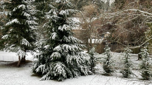
Edmonds got a layer of snow overnight. The suburb expects more Monday. (Photo by Bill Kaczaraba)
(Photo by Bill Kaczaraba)
It looks like the Seattle area will be hit with 4-6 more inches of snow overnight Monday. Issaquah could get a foot.
“Look for the snow to return tonight,” KIRO Newsradio meteorologist Ted Buehner said on The Gee & Ursula Show. “There’s enough moisture to generate a few inches in the metro Seattle area. There will be more north of the city.”
A winter storm will impact the area tonight and Tuesday, bringing widespread snow accumulation to both the lowlands and the mountain passes. Those planning to travel tomorrow need to be prepared for winter driving conditions. #wawx pic.twitter.com/XACVyjYwCS
— NWS Seattle (@NWSSeattle) December 19, 2022
According to the KIRO 7 weather blog: “By this evening and through most of Tuesday, the next system begins to move onshore, increasing snow chances once again. This one is moving farther south than the one that brought snow to the North Sound yesterday, so this next system is expected to be more impactful and widespread. Right now, totals in the lowlands look to be around 2-3″, but some isolated high totals are likely as well.”
No more snow days for Seattle Public Schools, remote learning instead
“The challenge of predicting any weather in the area is that it’s [a] terrain driver,” Ted said. “Usually, Alderwood Mall is ground zero for the Puget Sound convergence zone, but that won’t matter much in this snow event.”
Gee asked Ted how he deals with snow and ice events in the area. “I keep snow shovels in the trunk of my car,” he said. “Kitty litter also helps if you get stuck.”
🏔️Are you planning to travel on any of our passes? Check out our mountain pass page https://t.co/XcJ23jVFmv for conditions & specific requirements on all of our state passes.
‼️Please be prepared to follow posted requirements, know how to use chains & have an emergency car kit. pic.twitter.com/Ny5yBYgKoa— WSDOT North (@wsdot_north) December 19, 2022
The passes remain difficult. A Winter Storm Watch has been issued until late Tuesday.
The potential of more than another foot of snow on the passes is possible.
KIRO 7 weather reports: “The next in this series of disturbances are forecast for Thursday. As of now, there is still some uncertainty as to what kind of precipitation we will see. There is still plenty of cold air in place, and computer models have continued trending temperatures downward. Stay tuned for more on this forecast in the coming days.”
By Friday and through the weekend, including the Christmas holiday, temperatures will warm some, resulting in the change from snow to rain.
As snow turns to rain late in the week, KIRO 7 meteorologist Ilona McCauley says the chances of a White Christmas are trending downward.
KIRO 7 TV contributed to this report.