Prepare for dangerously low temps, ice storm across Puget Sound
Dec 21, 2022, 4:36 PM

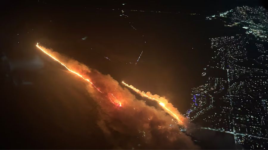
Just as we start to get past the dangerously cold temperatures, another hazard arrives Thursday evening; falling snow will turn to freezing rain overnight. (Photo by Brad Vest/Getty Images)
(Photo by Brad Vest/Getty Images)
The snow blanketing the region creates images worthy of a Christmas card, but it will make for some hazardous conditions over the next few days — besides the numerous road troubles that drivers have already seen.
Temperatures will not get above freezing today and tomorrow for Western Washington.
Snow stops but cold temperatures make an ‘icy mess of our roads’
“In the greater Seattle area, we’re going to see temperatures struggling to get above freezing — not even getting above freezing — primarily between the mid- to upper-20s,” said Dev McMillian, a meteorologist with the National Weather Service’s Seattle office. “And through the day tomorrow, it could be even a few degrees colder.”
Overnight, temperatures will get even more extreme.
“Western Whatcom County, they could dip into the single-digits — maybe a bit warmer for locations right along the water … and across the teens for much of Western Washington,” McMillian said.
This level of cold is not just uncomfortable, but dangerous. Spending prolonged amounts of time outdoors in the teens or single-digits can lead to conditions like frostbite and hypothermia. The National Weather Service cautions that exposed skin can become frostbitten in as little as 30 minutes at those temperatures, or even more quickly than that if winds are strong.
If you are curious of what the wind makes your temperature feel like, here is a chart to help you pin point the wind chill and the potential for frostbite with exposure. #wawx #orwx pic.twitter.com/zVTxLfeATI
— NWS Pendleton (@NWSPendleton) December 19, 2022
Hundreds of flights canceled out of Sea-Tac due to snow
Although this is the time of year when many holiday events take place outdoors, McMillian said this is not the night to go out caroling or ice skating. He also advises people to bring their pets inside.
“If you don’t have to necessarily be out, don’t even try to do it,” McMillian said.
Just as we start to get past the dangerously cold temperatures, another hazard arrives Thursday evening; falling snow will turn to freezing rain overnight.
“We’re going to see snow beginning to start things off, and then as conditions gradually warm up and snow levels rise, we’re going to see a transition to freezing rain overnight and into the morning commute for Friday, which could be very perilous,” McMillian said.
This ice storm will create extremely slick roads and poor visibility on the morning drive to work. McMillian said the region could see as much as a quarter-inch of freezing rain accumulate on Friday. If possible, he said, try to stay off the roads on Friday. If you must drive, take precautions.
“Definitely drive slower than usual,” McMillian cautioned. “Allow some time between you and the car in front of you.”
The snow will melt over the weekend, as temperatures make a dramatic shift. By Christmas Day, we could see highs around 50.