
All Over The Map: How Chelan, Clallam and Clark Counties got their names
Sep 18, 2020, 11:19 AM | Updated: 1:32 pm

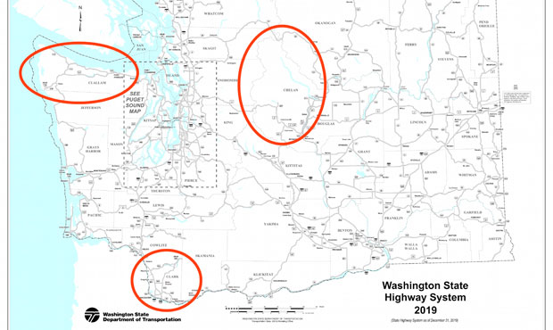
KIRO Radio’s Friday morning feature All Over The Map is exploring the origins of the names of all 39 counties and county seats in Washington. In the first installment last month, the series was introduced, and the stories of Adams, Asotin, and Benton counties were presented.
This month, the alphabetical journey around the Evergreen State continues with Chelan, Clallam and Clark counties.
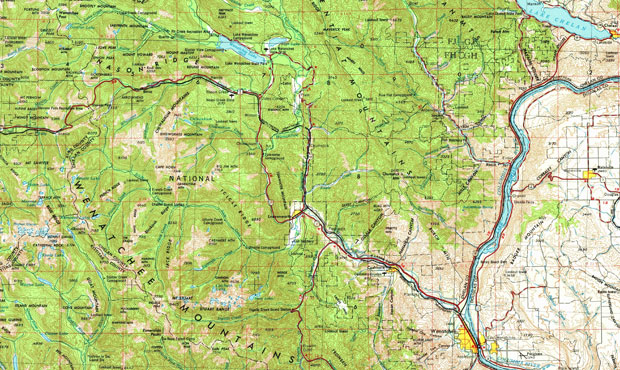
Chelan County
Chelan County in North Central Washington was created by the state Legislature – from parts of Kittitas and Okanogan Counties – on March 13, 1899. It was supposed to be called Wenatchee County, but somehow, the name was switched to Chelan at the last minute.
The name “Chelan” derives from a Native word that was first put to paper by Alexander Ross. From 1810 to 1813, Ross wrote about the people and places he encountered during his time working for a fur company based in Astoria. He traveled up the Columbia River to the interior of what’s now Washington, and used the word “Tsill-ane” when describing the Natives. Descendants of the Tsill-ane are part of the Confederated Tribes of the Colville Reservation.
The meaning of “Chelan” has been reported by various researchers over the years to mean “deep water” – which certainly applies to Lake Chelan – or “land of bubbling water.”
The county seat is Wenatchee, which is also a Native word that was applied to the river that enters the Columbia there. Wenatchee first appears in print courtesy of the journals of the Corps of Discovery’s Meriwether Lewis and William Clark – to describe the Indigenous people and the river – though the two captains spelled it differently: “Wahnaachee.”
Lewis and Clark, as anyone who has read their journals knows, often spelled the same word many different ways.
Going back to the late 19th century, various scholars have written about the meaning of “Wenatchee,” including “river issuing from a canyon,” as well as “boiling waters” (similar to “bubbling waters” above, of course) and “good place.”
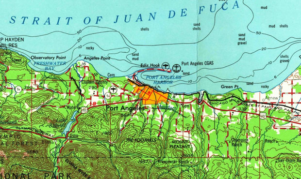
Clallam County
Clallam County, on the northern part of the Olympic Peninsula, was created on April 26, 1854, from part of Jefferson County by the Washington Territorial Legislature. Earlier, Jefferson County had been carved from Thurston County, after Thurston County had been carved from Lewis County.
“Clallam” derives from a Native term with many different English spellings. Missionary descendant and scholar or Northwest Natives Myron Eells spelled it “Do-skal-ob,” and Territorial Governor Isaac Stevens spelled it “S’Klallam” in the 1855 treaty for that part of what was then Washington Territory. Historians and the Jamestown S’Klallam Tribe say that Clallam means “strong people” or “brave people.”
The county seat is Port Angeles, a bustling maritime community situated on the Strait of Juan de Fuca.
A much longer version of the city’s name was first applied by Spanish explorer Captain Francisco Eliza in 1791. That version was “Porto de Nuestra Senora de los Angeles” – or, in English, “Port of Our Lady of the Angels,” for the Virgin Mary.
That name got shortened a year later by two other Spanish explorers to “Porto de los Angeles,” and then anglicized later that same year in 1792 by British explorer Captain George Vancouver. That new shorter version, Port Angeles, is the one that stuck. However, this whole name-shortening business went a step further in Clallam County, as many people who grew up in Port Angeles in the late 20th century just call the place “P.A.”
Incidentally, what’s now Los Angeles, California, was first given a similar (and similarly long) Spanish name about a decade before Porto de Nuestra Senora de los Angeles.
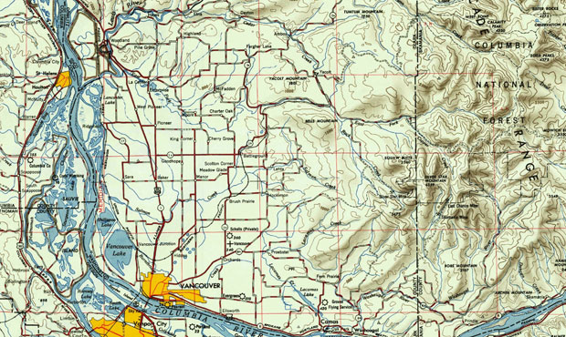
Clark County
Clark County in Southwest Washington is named for Corps of Discovery explorer William Clark. It was part of an area first organized by the provisional “DIY” government – before the Oregon Country officially American territory – as early as 1844.
What’s now Clark County was a section of what was called the “Vancouver District,” a sprawling part of pre-American Oregon Territory. The Vancouver District was huge, stretching from the Pacific Ocean to the Rockies, and from the Columbia River to 54-40 north latitude. The district shrunk drastically in size when the Treaty of 1846 set the northern United States boundary at the 49th parallel.
The area was known briefly as Vancouver County, but became Clark County on Sept. 3, 1849. Errors by the Washington Territorial Legislature enshrined the misspelling of “Clarke” (with an “e” on the end) that weren’t officially remedied until the 1920s.
The county seat is Vancouver, which is named for the Hudson’s Bay Company fort that was established there in 1825. The fort was named, of course, for Captain George Vancouver.
Collect all 39 Washington Counties!
In the next installment in October: Columbia, Cowlitz, and Douglas counties.
You can hear Feliks every Wednesday and Friday morning on Seattle’s Morning News and read more from him here. If you have a story idea, please email Feliks here.


