‘Catastrophic’ flooding possible as State Emergency Center reaches highest activation level
Dec 10, 2025, 7:16 AM | Updated: 10:44 pm

The State Emergency Operations Center has elevated to a Level 1 activation — the highest level possible — as heavy rain and strong winds continue across Washington.
The center is in constant contact with local emergency managers, closely tracking the impacts. Washington Governor Bob Ferguson said state emergency personnel are prepared to assist communities if needed.
The Washington National Guard has resources on standby.
The State Emergency Operations Center elevated to a Level 1 activation this afternoon — the highest level of activation — due to the ongoing rain and wind.
The center is in constant contact with local emergency managers and closely monitoring weather impacts.
Our state…
— Governor Bob Ferguson (@GovBobFerguson) December 10, 2025
The National Weather Service (NWS) stated that “catastrophic” flooding could occur at the Skagit and Snohomish Rivers.
“Locally catastrophic flooding impacts are possible along Skagit and Snohomish Rivers,” NOAA’s National Water Center said Wednesday morning. “Major and/or record flooding is expected, bringing an increasing threat to life and property. Overtopping of levees is possible.”
The Skagit River rising in Mount Vernon, Skagit County, WA pic.twitter.com/vFptWdJtJT
— James L. (@James_KIRORadio) December 10, 2025
The San Juan County Department of Emergency Management is warning island residents not to travel to Skagit County unless it’s absolutely necessary.
“The peak of the flooding in Mt. Vernon is currently forecast to occur at 4 a.m. on Friday, Dec. 12. It is not clear exactly when flooding could impact the highways, but it could potentially occur during the day on Thursday, Dec. 11,” the San Juan County Department of Emergency Management stated. “Islanders are strongly encouraged to delay non-critical travel until after the flooding has receded and it has been confirmed that the roads are open. Road conditions are available on the WSDOT map.”
RELATED STORIES


Second wave of atmospheric river to dump up to 15 inches on Cascades
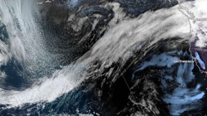
A massive atmospheric river that hit the Puget Sound region on Monday shifted further south on Tuesday, but is heading back.
Kirby Cook, a meteorologist with the National Weather Service in Seattle, explained that this time, it could dump eight to 15 inches of rain in the central Cascades.
“One of the unique things about this storm system is that it’s kind of like a one-two punch,” Cook said. “It’s sort of like two waves coming down the rivers from the mountains. It’s that second crest that’s going to be on top of whatever water was there before.”
Flood warnings for 23 Western WA rivers
More than 10 rivers reached Flood Phase 4, the highest warning phase.
The Snoqualmie River reached Flood Phase 4 at 5 a.m. Tuesday, King County reported.
“The river is expected to rise to a crest of 60.0 feet [Thursday] afternoon,” officials stated. “It will then fall below flood stage late Friday morning.”
#Flooding at #Snoqualmie Falls and River – worst in 10 years! 24 rivers flooded across the state – Gov has activated the highest emergency level! @KIRONewsradio @Mynorthwest pic.twitter.com/CclDVjl4dB
— Luke Duecy (@LukeKIRO) December 10, 2025
Phase 4 means residential areas could experience “dangerously high velocities and flooding of homes,” officials wrote. Additional roads that could overtop are Moon Valley Road S.E., S.E. David Powell Road, most of Neal Road S.E., SR 202 upstream of Fall City, W. River Road, S.E. 19th Way, portions of Fall City-Carnation Road S.E. (SR 203), N.E. 16th Street, N.E. 100th Street, N.E. 124th Street, N.E. 138th Street, N.E. Woodinville-Duvall Road, and 288th Ave N.E.
“The Snoqualmie River will cause major flooding from the town of Snoqualmie downstream through Fall City, inundating most of the farmland in the flood plain, some residential areas, and many roads,” officials stated.
The Skykomish River also reached Flood Phase 4, with possible riverbank erosion and flood debris. As of 5 p.m. Tuesday, the river remains in Flood Phase 4.
“The Skykomish River will cause severe, near-record flooding from Index downstream to Monroe,” officials stated. “The river will flood many homes, cover much of the farmland, close most roads, and overtop most dikes.”
In addition to the Snoqualmie and Skykomish rivers, the Cedar River, the Cowlitz River, the Grays River, Issaquah Creek, the North Fork Stillaguamish River, the Puyallup River in Orting, the Skagit River, the Snohomish River, the South Fork Nooksack River, and the Stillaguamish River are all at Phase 4 flooding levels.
“At 33.0 feet, the Snohomish River will cause severe near-record flooding,” officials stated. “Flood waters will likely overtop levees with major levee damage possible.”
Additionally, the Skagit River is expected to set new flooding records.
The Chehalis River, the Cowlitz River, the Green River, the Naches River, the Nisqually River, the Nooksack River, the Satsop River, the Skokomish River, the Skookumchuck River, South Prairie Creek, the Wenatchee River, the White River, and the Yakima River at Horlick, Parker, and Kiona are all at Phase 3 flooding.
Contributing: Heather Bosch, KIRO Newsradio; Julia Dallas, MyNorthwest
Follow Frank Sumrall on X. Send news tips here.