
Sistek: Charge batteries, prepare for gnarly afternoon commute in Seattle. Don’t even think about going across the passes
Mar 11, 2026, 7:15 AM | Updated: 7:32 am
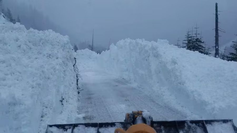
Snow being cleared in Stevens Pass during a 2024 snowstorm. (Photo courtesy of KIRO 7)
(Photo courtesy of KIRO 7)
If you’re thinking about heading over the mountains today, don’t.
That’s the bottom line from meteorologist Scott Sistek of The Emerald City Weather Blog, who joined “Seattle’s Morning News” on KIRO Newsradio Wednesday morning with a stark forecast: blizzard conditions in the Cascades, a damaging windstorm for the lowlands, and more trouble on the way next week.
RELATED STORIES
Blizzard warnings in effect for Cascades and Olympics
Blizzard warnings are in effect for Stevens Pass, Snoqualmie Pass, and the Olympics. Heavy snow combined with wind gusts of 45 to 50 miles an hour will create whiteout conditions in the mountains through tonight and into Thursday.
“You do not want to be in the mountains later today, this evening, or tonight,” Sistek said.
He cautioned against reading too much into any brief window of improvement at Snoqualmie Pass.
“There may be a brief period this afternoon where the snow level goes up over Snoqualmie Pass and changes it to rain, but it might only last a few hours,” Sistek said. “I don’t think you want to chance it. It’s coming back.”
Puget Sound windstorm: Peak gusts 5 to 8 p.m.
For the lowlands, the story is wind and heavy rain. Sistek said the storm center hits Vancouver Island around 2 to 3 p.m. Wednesday, sweeping across inland British Columbia before pulling winds up through western Washington.
“Mid-to-late afternoon, the winds will start picking up,” Sistek said. “Your evening commute today, Seattle, Tacoma, Puget Sound, pretty windy.”
Peak wind time is 5 to 8 p.m., with gusts of 45 to 50 miles an hour expected across the region. Coastal areas, northern Puget Sound, and areas near the water could see gusts to 55.
A secondary wind surge is expected between 8 and 11 p.m., driven by west winds down the Strait of Juan de Fuca. That surge would affect Port Angeles, Sequim, Whidbey Island, Camano Island, the San Juans, and parts of Snohomish and Skagit counties.
“That’s where I think Whidbey Island, Camano Island, the San Juans, maybe even Skagit, western Snohomish County, North King County, and northeastern Kitsap County might get gusts of 50 miles an hour out of the west or northwest,” Sistek said. “That could be more problematic than the south winds from a few hours earlier.”
Power outages and commute impacts
Sistek said the wind is borderline for serious damage but worth preparing for. Trees aren’t fully leafed out yet, which helps, but the west wind direction is unusual and could catch trees off guard.
“Probably not a bad idea to charge your batteries and prepare for a gnarly afternoon commute,” he said.
Even if gusts stay on the lower end, the combination of heavy rain and wind will make driving miserable.
“There’ll probably be puddles on the road, windshield wipers on full blast,” Sistek said. “It’ll be a long afternoon commute, long evening commute. Just be ready. Maybe push your dinner plans back a little bit.”
Skiers: This weekend is your window
The mountains will keep snowing through Thursday and Friday before a brief break this weekend. Sistek said Saturday into Sunday is the sweet spot for ski conditions before the next round of weather moves in.
“If you had to pick a day, Saturday into Sunday, there’s your perfect snow day,” he said.
Another atmospheric river targets the Pacific Northwest next week
The bigger concern is what comes after the weekend. Sistek said a warm atmospheric river is setting up to hit the region early next week, Sunday through Tuesday, with snow levels rising to 6,000 to 8,000 feet.
“It’s a warmer system, kind of like the ones we had in December and November, starting in Hawaii and making a beeline up into the Northwest,” Sistek said. “It is possible we’re going to go through another round of this early next week, just a much warmer round.”
That means heavy rain on top of fresh mountain snow, raising flooding concerns. Sistek said the situation isn’t as dire as December because there will be snow in the mountains to absorb some of the rain, but the combination still warrants watching.
“It’s still not good anytime you’ve got snow levels of 8,000 feet and a whole lot of rain coming in on top of it,” he said.
The bottom line for Western Washington: brace for a rough Wednesday evening, a snowy mountain week, a brief weekend break, and another wet system arriving early next week.
For the latest forecast, visit Sistek’s Emerald City Weather blog at emeraldcityweather.com.
Charlie Harger is the host of “Seattle’s Morning News” on KIRO Newsradio. You can read more of his stories and commentaries here. Follow Charlie on X and email him here.












