Kitsap Peninsula, Hood Canal wake up to early morning snow
Mar 15, 2021, 7:34 AM | Updated: 4:59 pm
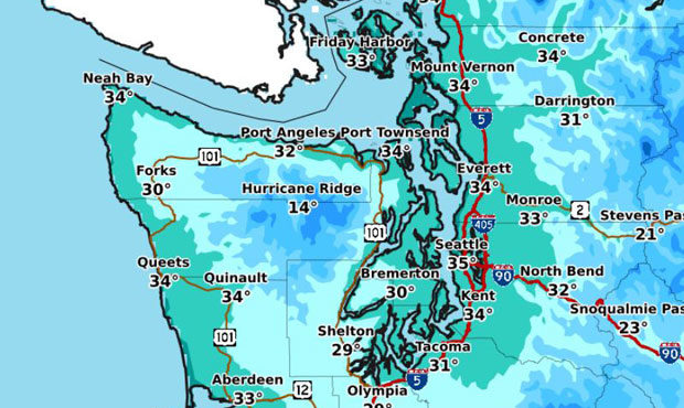
Frigid temperatures set in across the region Monday morning. (NWS Seattle)
(NWS Seattle)
Parts of the Hood Canal and Kitsap Peninsula woke up to snow early Monday morning, ahead of sunshine in the forecast for the early part of the week.
Snow levels dropped to 500 feet overnight between Sunday and Monday, brought on by a convergence zone moving across the Puget Sound region. That saw snow reported in parts of Bonney Lake, Edgewood, Agnew, Seabeck, Sequim, and Port Orchard.
Some Bonney Lake snow! #NickKnows #wawx https://t.co/iHM5O0yNkG
— Nick Allard (@NickAllardKIRO7) March 15, 2021
There was little, if any, accumulation “with just a light trace possible on non-paved surfaces,” said the National Weather Service.
Drier weather moved in for the remainder of the day, and will be followed by clear skies into Tuesday morning with frigid early temperatures between 20 and 30 degrees. Dry, partly-cloudy conditions will likely persist through Wednesday, before a series of systems of rain arrive Thursday.
That will see rain stick around in the forecast through the coming weekend and into early next week.
Follow @http://twitter.com/Mynorthwest