Seattle’s blistering summer wraps up with cooler than normal temperatures
Aug 24, 2021, 11:47 AM
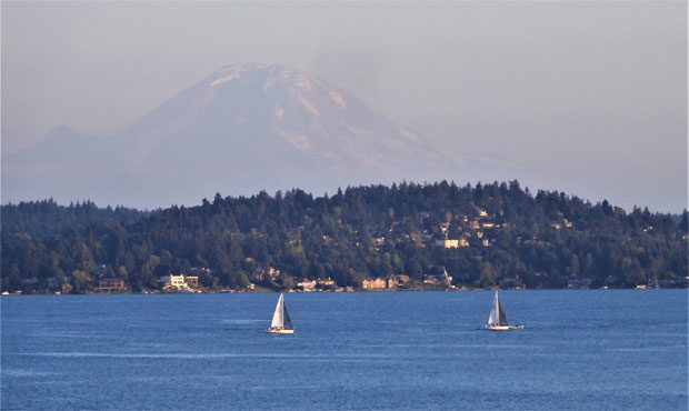
Lake Washington with Mt. Rainier in the background. (NWS Seattle, Twitter)
(NWS Seattle, Twitter)
At the tail end of a summer punctuated by record-setting heat, temperatures in the Seattle area have now dipped below normal in each of the last four days.
Wildfires in Winthrop are becoming ‘horrendous annual tradition’
Summer in the Puget Sound region kicked off in earnest in late June. That saw temperatures skyrocket up to 108 degrees, shattering numerous records, and setting the mark for the hottest recorded day on record for Seattle, Olympia, and many others.
A second heat wave arrived in mid-August, this time with temperatures ranging into the low-90s alongside poor air quality brought by wildfire smoke. That came at the tail-end of a 51-day dry streak, just short of the 55-day record set in 2017.
Things have cooled off considerably since then, punctuated by four days in Seattle below normal temperatures between Friday of last week and this Monday. Should that extend to Tuesday, that would mark the first five-day streak of below-normal days for August since 2012.
Low in Olympia this am of 41° was the coldest low since June 9th & the coldest August low in Olympia since 41° Aug. 25, 2015. Seattle has had 4 days in a row with below normal temps. Last time 5 in a row below normal in Aug, Aug. 27-31, 2012. Temps near normal next 2 days. #wawx pic.twitter.com/CN91PVlL1L
— NWS Seattle (@NWSSeattle) August 24, 2021
The National Weather Service expects highs to reach 77 degrees on Tuesday and Wednesday, before dipping back under 70 degrees Thursday and Friday with a chance of late-week rain.
Beyond that, the NWS notes that “nothing especially interesting is going on in the weather through Wednesday,” with heat and smoke likely to remain mild.
Follow @http://twitter.com/Mynorthwest