
Dry, sunny stretch ahead for Western WA with limited rain through early May
Apr 24, 2026, 6:00 AM | Updated: 6:05 am

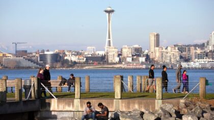
The Space Needle stands over the Seattle skyline. (Photo: John Moore, Getty Images)
(Photo: John Moore, Getty Images)
Spring sunshine and warmer temperatures are anticipated heading into this weekend and well into next week. After a few days of spring showers and below-average high temperatures this week, sunshine is expected to return in time for the final weekend of April.
Pollen status
The recent rainfall helped wash a lot of pollen out of the air, much to the relief of allergy sufferers. Unfortunately, the return of spring sunshine means pollen counts are quite likely to rise sharply. For the latest pollen count numbers, visit the NW Asthma and Allergy Center. Trees remain the primary pollen source.
Driving the weather change
Higher pressure aloft over Western Canada is forecast to build over the region, resulting in clearing skies and warming temperatures across Western Washington into this weekend. High temperatures are expected to climb into the 60s. The average high temperature for the latter part of April is in the lower 60s.
The clearing skies and lack of cloud cover also means nighttime temperatures will cool off. Overall, low temperatures are expected to range from the mid-30s to the lower 40s across Western Washington. However, the usual colder locations, such as the south sound, parts of the Southwest Interior, and even North Sound spots like Arlington, could have some frost.
RELATED STORIES

Mountains
For those with weekend plans in the mountains, the freezing level is expected to hover between 5,000 and 6,000 feet. There is also the possibility of a late-day pop-up shower, mainly on Sunday.
Fine weekend weather for the outdoors
Otherwise, the weekend weather looks fine for outdoor activities across Western Washington. The Skagit County Tulip Festival is a major event, and will likely be very busy. Ballgames and Sunday’s Whidbey Marathon are other activities taking advantage of the good weather.
Days getting longer
The year’s first 6 a.m. sunrise is slated for Sunday morning. The first 8:30 p.m. sunset is just about two weeks away, occurring on May 7.
Each day is growing longer by about three minutes at this time. As the calendar moves closer to the summer solstice on June 21, the rising length of days will slow until it is just a matter of seconds by late June. 9 p.m. sunsets will be common then.
Looking ahead
Looking ahead to next week, the higher pressure aloft is expected to remain in place. Temperatures across Western Washington are forecast to warm well into the 60s, with some of the usual warmer spots like the Cascade foothills and Southwest Interior likely cracking the 70-degree mark. Lows should moderate, cooling mainly into the 40s.
The next threat of rain is not foreseen until the first weekend of May, and even then, that is not a certainty. The opening of boating season in the region is slated for Saturday, May 2.
Rainfall status
The annual rainfall to date is close to average, thanks to the wet months of March and the first half of April. The dry finish to this month means some Western Washington locations may end the year below average.
Seattle-Tacoma International Airport (SEA) is just under a half inch above average for the year thus far. Olympia, though, is currently just over an inch below average, while Bellingham is two inches above average.
Drought status
Regarding drought conditions, Western Washington is in good shape. Eastern Washington is drier than normal, given the latest drought monitor conditions. The mountain snowpack finished the winter season at about 50% of normal as of April 1. With the warmer weather, the limited snowpack is melting, meaning drought conditions are likely to worsen.
The final days of April look to have plenty of spring sunshine and warmer-than-average high temperatures. For allergy sufferers though, prepare in advance for a rise in pollen. As the old phrase goes, those April showers will bring May flowers.
Ted Buehner is the KIRO Newsradio meteorologist. Follow him on X and Bluesky. Read more of his stories here.












