Sistek: Western WA’s weather nightmare finally easing; White Christmas ‘not zero’ chance for Seattle
Dec 17, 2025, 1:59 PM | Updated: Dec 22, 2025, 10:22 am
Western Washington’s December 2025 weather nightmare is finally easing.
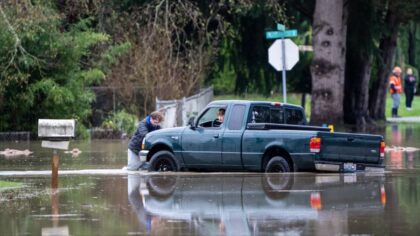
After two weeks of relentless atmospheric rivers, record-breaking flooding, and an overnight windstorm that left 380,000 customers without power across the state, meteorologist Scott Sistek said the worst is behind us.
“I would say we are past the worst of it,” Sistek, author of the Emerald City Weather Blog, told “Seattle’s Morning News” on KIRO Newsradio Wednesday morning. “The peak was really overnight.”
Those 380,000 customers translate to close to a million people in the dark. Utilities count each power meter as one customer, so a single-family home counts as one, but so does an apartment building with dozens of units. The actual number of people affected is typically two to three times the customer count.
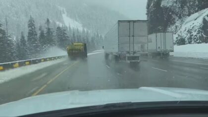
High winds battered the region Tuesday night into Wednesday, with a powerful westerly surge racing down the Strait of Juan de Fuca and slamming into Whidbey Island and Snohomish County. A blizzard warning kept Cascade mountain passes dangerous through the morning, but the storm’s intensity is fading and conditions are improving.
December 2025 storms rank among worst in Washington history
Asked to compare this stretch of weather to past events, Sistek pointed to the notorious winters of 1990 and 1996, both of which featured severe flooding followed by snow and Arctic blasts.
“Every storm is unique,” Sistek said. “I’d say it’s probably a 7 or 8 out of 10 for history.”
He said the overnight windstorm, while damaging, was not as catastrophic as some models had predicted. Sistek said he feared the power outage numbers would climb much higher given how the forecast models were trending.
“Even going into late last night, we were really bracing ourselves, thinking it could be a lot more,” Sistek said.
Western Washington flooding finally receding
For communities devastated by flooding along the Green, Skagit, Snohomish, Snoqualmie, and White Rivers, relief is coming.
“I looked, there’s no purple on the river forecast map anymore,” Sistek said. “Purple means major flooding. There are no more rivers on ‘major flood’ warning.”
The shift from warm rain to cooler temperatures means the mountains are now receiving snow instead of rain, cutting off the runoff that had been feeding swollen rivers for days.
“Now that we’ve stopped raining in the mountains and it’s turned to snow, we’ve stopped supplying the rivers with all this runoff,” Sistek said. “Whatever flooding is there should be starting to recede.”
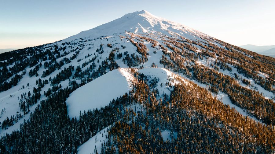
Snowpack finally building at Snoqualmie Pass, Cascade ski resorts
The cooler pattern is good news for Washington’s water supply and ski resorts. Sistek noted that Snoqualmie Pass had virtually no snowpack before this week’s storm.
“I joked yesterday writing my blog: Snoqualmie Pass was supposed to get 10 to 15 inches with this storm, and that’ll put their snowpack at 10 to 15 inches because there’s been nothing there,” Sistek said.
Long-range forecasts show wet, cool conditions continuing through Christmas and into New Year’s week, building the mountain snowpack that is critical for summer water supplies.
RELATED STORIES

White Christmas in Seattle? Sistek says chances ‘not zero’
With Christmas a week away, we had to ask: any chance of snow in the Puget Sound lowlands?
Sistek was cautious, noting some models are toying with lower snow levels next week but that he was not ready to make a prediction.
We pressed him. Is the chance of a White Christmas zero?
“It’s not zero,” Sistek said. “Maybe like 0.5%.”
We kept pressing.
“It’s probably higher. I haven’t done the statistical analysis,” he admitted. “Maybe call it 12%. It’s not going to be 50%.”
One in eight? We’ll take those odds.
Charlie Harger is the host of “Seattle’s Morning News” on KIRO Newsradio. You can read more of his stories and commentaries here. Follow Charlie on X and email him here.
Follow @https://twitter.com/kirocharlie