
Where did the sun go? Clouds blanket region but warmth will return by Thursday
Apr 27, 2026, 1:30 PM | Updated: 1:52 pm

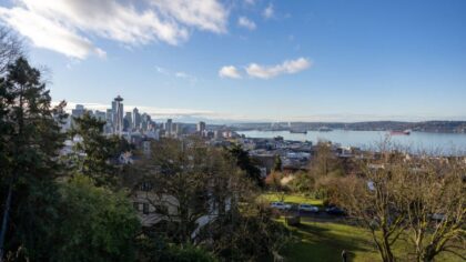
Clouds hang over Seattle. (Photo: Chris Connelly via Flickr Creative Commons)
(Photo: Chris Connelly via Flickr Creative Commons)
Many are asking – what happened to the weekend sunshine?
Rising low-level onshore flow from the Pacific Ocean into western Washington overnight resulted in marine clouds blanketing much of the region Monday morning. The cloud cover is rather thick. If flying out of the Seattle-Tacoma International Airport (SEA) or Everett – Paine Field, the flight would pop into pure sunshine above the clouds at about 4,000 to 5,000 feet.
Some sunbreaks are possible late Monday, yet it’s a rather fleeting chance. Temperatures are expected to be close to 10 degrees cooler than over the weekend, with highs struggling to climb above 60 degrees.
Tuesday promises a repeat of Monday with more persistent marine clouds and high temperatures around 60 degrees. The blanket of clouds will keep temperatures low to moderate, only dropping into the 40s.
Change coming Wednesday
By Wednesday, higher pressure aloft is forecast to build over the region, and the low-level onshore flow coming from the ocean is anticipated to taper off. The change in the overall weather pattern means the sun will return with highs climbing into the 60s.
Thursday is expected to offer plenty of sunshine with yet warmer temperatures. Highs are forecast to continue their ascent, rising into the range of the mid-60s to mid-70s across western Washington.
The marine clouds are anticipated to make a brief return Friday morning and then give way to afternoon sunshine. The coming weekend looks to provide more sunshine. By Sunday, high temperatures are expected to warm into the 70s in many western Washington locations.
At SEA, the warmest temperature so far this year was 74 degrees on April 19. High temperatures on either Thursday or Sunday could top that threshold.
The mountains
In the mountains, freezing levels are expected to be around 6,000 feet through Tuesday, and then rise to 8,000 feet or higher the rest of the week and through the coming weekend. Afternoon pass temperatures will range from the 50s to mid-60s.
There is the slim possibility of a late-day isolated shower through Tuesday.
RELATED STORIES

Next chance for rain?
For those asking when it will rain again, there is no rain in sight at this point. Longer-range forecast charts do not indicate any threat of rain well into next week. So the month of April will finish dry, and the dry period will extend into at least the first week of May.
Some are also asking when there will be a warm 80-degree day. At SEA, the average first day of 80 degrees or better is May 20. Yet, nearly all the record highs at SEA hit 80 degrees or better through the first half of May.
Ted Buehner is the KIRO Newsradio meteorologist. Follow him on X and Bluesky. Read more of his stories here.













