Rough skies for Santa: Windstorm threatens power outages; no white Christmas
Dec 23, 2025, 5:00 AM | Updated: 3:16 pm
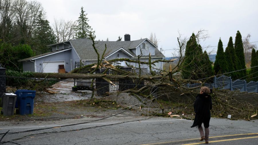
Local resident Tiffani Palpong stands in front of her property where her 20 year-old son Logan was still located, trapped by downed power lines and trees on November 20, 2024 in Lake Stevens, Washington. (Photo: Mathieu Lewis-Rolland, Getty Images)
(Photo: Mathieu Lewis-Rolland, Getty Images)
Santa may want to check the local western Washington weather before flying into the region on Christmas Eve.
Earlier on Monday, forecast guidance offered a new solution with an intensifying low-pressure system working its way north along the west coast from northern California to Vancouver Island. Yet from one piece of forecast guidance to another, there were differences in the track of this storm, plus its timing and intensity.
Ideally, a more solid solution should become clearer before Wednesday. Yet, a key message is to be prepared in case strong winds develop during the afternoon and potentially create power outages, and monitor the latest weather forecast information.
The worst-case scenarios have wind gusts out of the south from 40 to 60 mph across much of western Washington. Since recent rains have saturated soils, these kinds of winds would make it easier to topple trees, particularly those that were stressed and weakened during the strong wind event on December 16.
The southerly winds could also be less intense with gusts in the 20 to 40 mph range, reducing the threat of power outages. In addition, this wind event should be relatively short-lived, less than 6 hours in length.
Regardless, it is best to be prepared in advance of potential power outages. Have flashlights handy with fresh batteries. Avoid using candles since they can start fires. If using a generator, ensure it is properly ventilated outdoors to avoid any threat of carbon monoxide poisoning. Again, be sure to monitor the latest weather forecast information.
Snow on Christmas?
The weather on Christmas Day is expected to settle down with much lighter winds and decreasing showers across western Washington. High temperatures are forecast to be in the 40s. If Santa arrives during the early morning hours of Christmas morning, the weather should cooperate so he can safely make his rounds in the region.
One topic is more certain, and that is the odds of a White Christmas in the lowlands of western Washington are zero. Sorry kids. The incoming weather system will push snow levels temporarily up to 4,000 feet Wednesday before dropping below the passes again on Christmas Day. For those wanting snow on the ground for the holiday, head to the mountains.
Mountain Snow
Since Friday of last week, the snow has been piling up in the mountains. Mt. Baker and White Pass both now have over 50 inches of snow on the ground, while Crystal Mountain and Paradise have over 3 feet of new snow.
More snow is expected to accumulate through the rest of this week and extend into next week. Nearly all ski areas have finally opened, much to the delight of snow enthusiasts.
Another atmospheric river?
There was word over the weekend of another potential atmospheric river and heavy rain event over the coming weekend. That threat is essentially gone as the storm track will head well north into Canada. In fact, the last few days of the year could be relatively dry with some sunshine. Area rivers will have the opportunity to continue to recede.
RELATED STORIES
January to March weather outlook
A more typical La Niña weather pattern is reflected in the latest seasonal weather outlook released late last week by the National Weather Service’s Climate Prediction Center. Cooler and wetter than average conditions are anticipated from January into March. This trend is good news for helping to build a healthy mountain snowpack.
It also means there will be a better chance of snow in the lowlands of western Washington during January into early February.
Ted Buehner is the KIRO Newsradio meteorologist. Follow him on X and Bluesky. Read more of his stories here.