
Seattle weather calms for Thanksgiving travelers, but cold patterns may loom
Nov 26, 2025, 6:56 AM | Updated: 3:04 pm
Travelers heading over the mountains for Thanksgiving can breathe a sigh of relief as the worst of this week’s weather moves out, but meteorologist Scott Sistek warns that colder conditions could arrive by early December.
“The worst weather is behind us now,” Sistek, who also operates the Emerald City Weather Blog, said during an interview with Seattle’s Morning News. While Thanksgiving Day itself will bring traditional Seattle drizzle and blustery conditions, he said the holiday weekend should see drier, more manageable weather for those traveling to and from family gatherings.
The timing could have been worse for the millions of Pacific Northwest residents hitting the road, ferries, and the Seattle-Tacoma International Airport (SEA) for the holiday. Rain is common on Thanksgiving in Seattle, and this year will be no exception.
“It is pretty common to have rain here on Thanksgiving, and this is going to be just like another one of those days,” Sistek said.
Thanksgiving Day will feature light to moderate rain throughout the region, with breezy conditions at times. However, Sistek noted that an earlier forecast calling for a potentially strong storm has shifted, with that system now tracking farther south and taking the threat of significant winds out of the equation.
“It’s just going to be like a typical Seattle light-to-moderate rainy day,” Sistek said. “As Thanksgivings go, one that we should be able to handle pretty well.”
The meteorologist noted that the region has seen far worse Thanksgiving weather over the years, including the 1990 holiday when heavy rain flooded the I-90 bridge over Lake Washington, causing it to sink. Thursday’s conditions won’t approach anywhere near that level of severity.
Don’t expect much outdoor football tossing on Turkey Day, but the weather won’t be stormy enough to cause major disruptions. The few remaining leaves clinging to branches across the region will likely surrender to the wind and rain, Sistek said, but conditions will remain manageable.
RELATED STORIES


Travel forecast improves for weekend
The forecast improves significantly for travelers heading home, with drying conditions expected to begin late Thursday night and continue through the three-day weekend. Temperatures will cool slightly, with highs in the mid-40s and overnight lows dipping to the mid-30s in Seattle. Outlying areas could see some freezing temperatures.
For those traveling to Eastern Washington or other destinations across the mountain passes, conditions should remain clear through the weekend, though motorists should remain prepared for cold temperatures and potential icy spots, particularly in the early morning hours.
Cold air pattern pushes back, but December looks promising
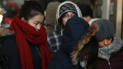
A large mass of Arctic air that forecasters had been tracking for the past week to 10 days now appears likely to shift eastward, impacting the northern Plains and areas east of the Rockies rather than the Pacific Northwest.
The cold air mass has been tantalizing weather watchers and winter enthusiasts for days, with long-range models showing the potential for significantly colder temperatures during or shortly after Thanksgiving week. But as is often the case with extended forecasts, the pattern has shifted.
“It’s been backing off a little bit, much to our disappointment,” Sistek said.
Most of that Arctic air will bypass the region, heading east of the Rockies instead. Early forecasts had suggested the cold snap could bring daytime highs only in the 40s and overnight lows in the 20s and low 30s across the Seattle area.
However, Sistek said the cold isn’t gone for good. The long-range forecast still shows below-average temperatures arriving in the first 10 days of December, which could finally bring meaningful snowfall to mountain ski resorts that have been waiting for the season to begin in earnest.
“We are still optimistic that December is going to end up below average for temps and maybe even a little wetter than average,” Sistek said. While the month may start relatively dry, he expects colder storms to eventually arrive, bringing snow to the mountains even if precipitation totals remain modest in the lowlands.
The forecast aligns with the ongoing La Niña pattern, which typically brings cooler and wetter conditions to the Pacific Northwest during winter months. While La Niña’s effects are often most pronounced in mid-winter, Sistek said impacts can begin to appear in late autumn and early winter.
“Usually La Niña really gets going closer to the heart of winter,” he said. “We can still see some impacts in late autumn, early winter, kind of where we are now.”
For skiers eager to hit the slopes, the news remains cautiously optimistic. The snow from this week’s storms should have added to the mountain snowpack, and the colder temperatures expected in December should help build a stronger base.
“We should at least start getting some snow in the mountains,” Sistek said. “That’ll help get the skiers going, and then hopefully get that really going by the time Christmas and the holiday weeks roll around.”
Meteorologist hopes region ‘due’ for white Christmas as La Niña develops
For snow enthusiasts wondering about the possibility of a white Christmas in Seattle, Sistek offered a glimmer of hope, though he was careful to acknowledge that the prediction is based more on wishful thinking than meteorological data.
“We are kind of due, I feel like,” he said, noting that Seattle averages a white Christmas every seven to 10 years. The last white Christmas in Seattle was in 2017, now eight years ago. “I don’t want to give up hope. I think we’re due.”
Sistek emphasized that it’s far too early for any concrete predictions about Christmas weather, noting that the sense of being “due” is more about statistical odds and personal optimism than anything showing up in current forecast models.
“It’s just because we’re still in the statistical odds here. It’s too far to see,” he said. “Doesn’t mean anything … but you kind of feel like the odds are going to catch up with us at some point.”
The meteorologist’s hopeful outlook reflects a common sentiment among Pacific Northwest winter weather enthusiasts, who eagerly await the rare occasions when snow blankets Seattle during the holiday season.
Memories of 1985: Seattle’s legendary Thanksgiving snowstorm
Sistek’s blog currently features a detailed retrospective of the Thanksgiving snowstorm of 1985, which occurred 40 years ago and remains one of the most memorable weather events in Seattle history.
That storm actually began the week before Thanksgiving, with the first snowfall dropping seven to eight inches on Seattle on November 21, 1985. Temperatures then plunged into a deep freeze, with highs only in the 20s and overnight lows falling to 10 to 15 degrees. The Apple Cup that year at Husky Stadium, dubbed the “Ice Bowl,” saw temperatures in the 20s, and officials reportedly had to put antifreeze in the stadium bathrooms to keep toilets functioning.
Just as conditions appeared to improve, a second storm hit the day before Thanksgiving, dumping another eight inches of snow. The combination of heavy snow, ice, and Arctic winds knocked out power across the region mid-afternoon on Thanksgiving Day, leaving families with half-cooked turkeys and forcing many to resort to Coleman stoves to finish their holiday meals.
Remarkably, it has not snowed on Thanksgiving or the day before in Seattle since that 1985 storm, a span of 40 years.
“You kind of feel like the odds are going to catch up with us at some point,” Sistek said. “It’s not impossible for it to snow in Seattle in November. It’s just rare, but not impossible.”
Charlie Harger is the host of “Seattle’s Morning News” on KIRO Newsradio. You can read more of his stories and commentaries here. Follow Charlie on X and email him here.












