Prepare now: Christmas Eve windstorm threatens western WA with 40-60 mph gusts, power outages
Dec 22, 2025, 10:55 AM | Updated: 6:34 pm

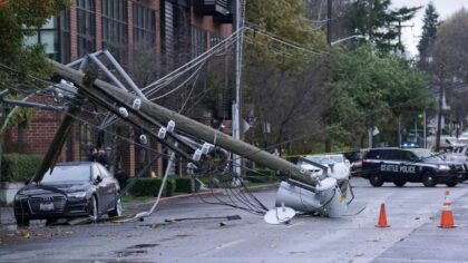
A person takes a photo of a downed power pole blocking E. Madison St. in Seattle after it fell during a storm. (Photo: Ted S. Warren, The Associated Press)
(Photo: Ted S. Warren, The Associated Press)
A sudden Christmas Eve windstorm threat has western Washington meteorologists scrambling Monday. The December 2025 storm, which was not in forecasts just 24 hours ago, could bring 40 to 60 mph wind gusts to Seattle, the Puget Sound region, and areas from the Oregon border to Vancouver, B.C. on Wednesday, raising concerns about widespread power outages just as families gather for the holiday.
“This wasn’t even on the charts yesterday,” said Ted Buehner, KIRO Newsradio meteorologist and retired National Weather Service forecaster, speaking to the Gee and Ursula Show Monday. “It came almost out of nowhere. That’s what worried me.”
Buehner said he was writing his weekly weather article for MyNorthwest Sunday and had no indication this storm was coming.
“When I was putting together the article yesterday, I really didn’t have any strong clue for any of this,” Buehner told “Seattle’s Morning News.” “It has developed since yesterday afternoon.”
RELATED STORIES
What forecasters are now seeing for Christmas Eve
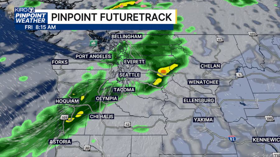
The latest guidance shows a developing low-pressure system that will hug the coastline from Northern California to Vancouver Island, moving up along the Washington coast and into Vancouver Island during the evening hours of Christmas Eve.
“We’re going to see increasing southerly winds not only along the coast but through the western interior, basically from the Willamette Valley all the way up to Vancouver, B.C.,” Buehner said. “Best guess on wind speeds: we may see gusts in that 40, 50, perhaps even 60 mile-per-hour range on Christmas Eve.”
Nick Allard, a KIRO 7 TV meteorologist, said Wednesday is “the day that could potentially be strong,” with winds possible from late morning or midday through late afternoon. But he cautioned that forecast models are not yet in agreement.
“None of them really agree right now,” Allard told “Seattle’s Morning News” Monday. “There is not a ton of agreement on what’s going to happen, but it has the potential to be very strong.”
Allard said he has not declared an alert day yet, preferring to wait for models to come into better agreement later Monday.
A quick, but potentially damaging storm
Buehner said the storm should move through relatively quickly, but that does not mean it will not cause problems.
“It’s going to be a quick one,” Buehner said. “It’ll come in, blow for about four hours or so, then taper off. Christmas Day looks pretty calm and quiet in comparison.”
The concern is what four hours of strong winds will do to trees already weakened by weeks of storms and saturated soils.
“Our soils are wet, so like we had a couple of Tuesdays ago, trees can fall pretty easily,” Buehner said. “Power outages, things like that, all on Christmas Eve. Horrible timing.”
How to prepare for Christmas Eve power outages
Buehner urged listeners to prepare now and spread the word to family and friends.
“Get ready,” he said. “If you lose power and have backup generators, make sure they are ventilated outside, not inside the house. If you don’t have a generator, have flashlights, not candles, with fresh batteries, and be ready to weather the storm.”
He warned that if power goes out, cooking Christmas dinner could become a challenge.
“If your power’s out, you might have a hard time roasting that turkey or prime rib,” Buehner said. “Have someone who knows how to handle a barbecue and keep it at low heat.”
Buehner also reminded listeners of the danger of carbon monoxide poisoning. During the Hanukkah Eve windstorm in December 2006, which left 1.8 million people without power, people brought heating elements inside to stay warm, resulting in carbon monoxide fatalities and hundreds of others poisoned.
No white Christmas, but snow if you head to the mountains
For those hoping for a white Christmas in the lowlands, Buehner had disappointing news.
“We’re not going to have a white Christmas. Sorry, kids,” he said. “Might be a windy one, but not a white one.”
But the mountains are a different story. Mount Baker has accumulated more than 50 inches of snow, as has White Pass. Other central Cascade locations have between two and three feet, with more piling up. Baker, Crystal, and White Pass have opened, and Alpental is set to open on Tuesday.
Buehner said La Niña has finally kicked in, which should help build a healthy mountain snowpack. As for lowland snow, he said the best chances would come in January or perhaps early February.
No more atmospheric rivers expected after Christmas Eve
For flood-weary residents, there is some good news. Buehner said talk of another atmospheric river around Dec. 28 appears to have fizzled.
“The latest guidance I saw: that ain’t happening,” he said. “Everything’s heading further north. After this system on Christmas Eve, we’re going to have tapering-off showers on Christmas Day.”
The forecast should come into sharper focus later Monday as new model runs arrive. Until then, meteorologists are urging residents to prepare for the possibility of another challenging night.
Charlie Harger is the host of “Seattle’s Morning News” on KIRO Newsradio. You can read more of his stories and commentaries here. Follow Charlie on X and email him here.