Seattle winter weather outlook: How much snow can we expect?
Dec 27, 2023, 11:15 AM | Updated: 11:53 am

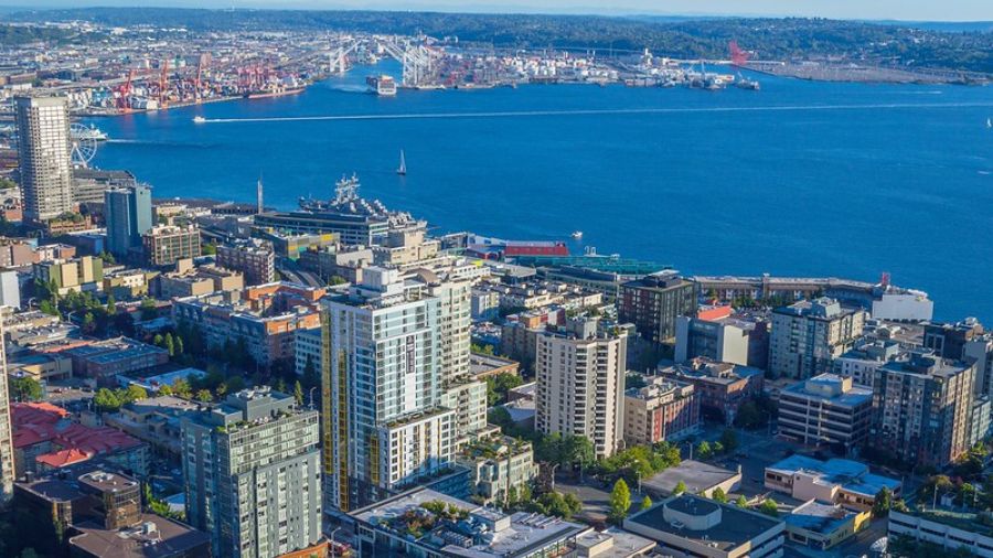
An overcast day in Seattle along Lake Washington. (Photo: Frank Sumrall/MyNorthwest)
(Photo: Frank Sumrall/MyNorthwest)
The latest seasonal weather outlook was recently issued by the National Weather Service’s Climate Prediction Center and offered a look at what the rest of this winter has in store, plus a peek at the remainder of the year.
The warming impact of El Niño is reflected in the outlook into March. Overall temperatures are anticipated to remain warmer than average for the three-month period of January through March with no significant trend for precipitation.
More on Washington weather: Anniversary of Puget Sound storm that brought 100 mph wind gusts
Those warmer-than-average temperatures translate to a reduced threat of lowland snow. That does not mean snow could not occur, yet the odds are lower. Over the decades, there have been a number of El Niño winters with no lowland snow. In contrast, four of the snowiest years on record since the 1950s were El Niño winters, including the all-time record 68.5 inches of snow that fell at Seattle-Tacoma International Airport (SEA) during the winter of 1968-69.
For the mountain snowpack, warmer El Niño winters are usually not good news. The average snow level tends to be higher resulting in a less-than-average snowpack once it reaches its peak around April 1. Water managers call the mountain snowpack “water in the bank” for summer and fall, and if the snowpack comes up short, water and wildfire managers’ concerns will rise.
This Week in Western Washington and the Cascades
The weather in Western Washington between Christmas and New Year’s Day reflects the warming of El Niño with high temperatures on either side of 50 degrees this week, three to five degrees above the average for late December.
An offshore Pacific weather system will spread rain onshore Wednesday. With surface high pressure parked over the Rockies, this incoming system’s lower pressure will also create strong pressure differences across the Cascades, producing blustery easterly gap winds focused along the west slopes and foothills. Gusts of 50 mph are anticipated overnight tonight through midday Wednesday raising the possibility of local power outages.
During the rest of the week, weather systems rotating northeast off the coast will maintain a threat of showers into the final weekend of the year. Low temperatures will remain mild, ranging from the mid-30s to the mid-40s across the region.
More from Ted Buehner: Increase in hazardous weather spurs bills to modernize systems
For those traveling across the Cascades or enjoying the snow slopes, snow levels will be on a rollercoaster through the week, ranging from about 4,000 feet to as high as 6,000 feet. Those east winds through the passes though will tend to keep those areas cooler, providing a wintry mix of rain and snow. Local brief freezing rain cannot be ruled out.
Looking Ahead to Spring and Summer
This winter’s El Niño looks to be a one-and-done event with sea surface temperatures in the Eastern Pacific Ocean moderating this spring and summer. The seasonal weather outlook though maintains good chances of warmer than average temperatures for this spring and summer. For precipitation, the odds tip toward drier than average from March through August, again a concern for water and wildfire managers.
Follow Ted Buehner, the KIRO FM news meteorologist on Twitter